| |
 |
| |
Lightning Talks
Eight speakers, five minutes each, bringing concise overviews of open source geospatial software, community building, open geodata projects, and amazing whizzy demonstrations!

Schuyler Erle, Troublemaker At Large
Schuyler is a long-time hacker, author, and Free Software activist.
Latent Semantic Analysis of the FOSS4G 2007 Conference Program
With the help of a little linear algebra, we can analyze the anonymized program rankings collected before FOSS4G 2007, and infer some conclusions about the nature of the conference and its attendees.

Chris Schmidt, Boy Genius, Metacarta Inc.
Chris is a software developer for MetaCarta, Inc. where he works in part on developing OpenLayers, TileCache, and FeatureServer, and working with MetaCarta to create an environment where MetaCarta can foster and contribute to open source geospatial development.
Understanding Software Patents
Software patents are a reality in today's global business environment. Learn how software patents affect you and the software you use and work on, and how open source projects can work together with the community and holders of software patents to protect themselves and their users.
Ed McNierney, Chief Mapmaker, TopoZone.com
Ed's been a CTO / VP of Engineering kind of guy for almost 30 years, creating spreadsheets, educational children's games, high-performance graphics hardware, and medical imaging software; in 1999 he discovered he lived at the corner of four USGS topographic maps and it was absurdly difficult to put them together into one map, so he invented TopoZone.
No One Wants 3/8-Inch Drill Bits
TopoZone started with highly customized, proprietary map-serving software and evolved into one of the largest known MapServer installations. The switch to an Open Source platform made TopoZone revisit and refocus on how the business provided value to customers and what we were really doing on the Web. The result was a valuable learning experience in what all of us are really doing on the Web, and why, and what our customers really care about.

Arnulf Christl, Director, OSGeo
Arnulf is Free Software advocate who started off as UNIX sysadmin on a Borg cube, turned to spatial, hacked some software and now makes a living out of orchestrating loosely distributed spatial data services and people living in them.
Polluter-Pays-Principle Applied to Public Geodata
Entities that change the environment should be obliged to document these changes following the Polluter-Pays-Principle to make the resulting geo data as freely accessible as air to breathe.

Andrew Turner, Neogeographer, Mapufacture
Andrew develops several open-source tools such as GeoPress and Mapstraction, participates in the formulation of light-weight geospatial standards like GeoRSS and KML, and works for Mapufacture, building a geospatial aggregation and search service. He also wrote O'Reilly's Introduction to Neogeography.
Beyond GPS - Neogeography Data Collection
GPS units have become inexpensive, ubiquitous, and integrated into our devices and services. We can share our hiking trails, or contribute to building OpenStreetMap. But what is the future beyond GPS capture? We'll do a quick dive through some of the sensors, aerial imaging platforms and other devices that neogeographers and the public are starting to explore and what they're doing with the data they gather.

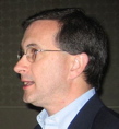
Peter Batty, CTO-in-Hiding
Peter has been CTO of Intergraph, Founder and CTO of Ten Sails, now Ubisense, and VP of Technology at Smallworld, now part of GE, and he is currently blogging and deciding what to do next.
The Past, Present and Future of the Geospatial Industry
This talk will summarize the past, present and future of the geospatial industry in five minutes!

Raj Singh, Director of Interoperability Programs, Open Geospatial Consortium
Raj Singh manages various software testbeds for the Open Geospatial Consortium and is one of the original developers of GeoRSS. He has a PhD in Planning Information Systems from the MIT Department of Urban Studies & Planning.
Spatial Standards Snapshot
A snapshot of a busy year for OGC in regards to FOSS interests, with topics including KML, REST and public access into parts of OGC's standards development process.

James Macgill, Google
James Macgill is a keen open source and open standards advocate and founder of the GeoTools project. He trained as a Geographer but has been coding as a hobby from the age of 12. He jumped at the opportunity to work on the fusion of computing and geography when he discovered GIS whilst studying environmental science.
Geospatial Summer of Code
This year Google sponsored more than a dozen students to work on OSGeo related projects under the Summer of Code program. Find out more about the SoC and how you can get involved in future.