| |
 |
| |
Workshops
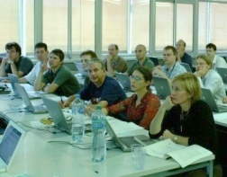
Workshops at FOSS4G are a unique experience to learn about open source software from the experts in a hands on environment.
- Workshops are 3 hour courses.
- Workshops are presented in full computer labs, with two attendees per computer.
- Workshops are presented on Monday, September 24, to registered workshops attendees only.
Morning Workshops
Based on the book GIS for Web Developers, this talk demonstrates how you can build your own Google Maps in-house using nothing but open source software. We also discuss integrating free, public domain data from sources like the US Census Bureau and the USGS.
W-02: Shuffling Quantum GIS into the Open Source GIS Stack
Quantum GIS (QGIS) is a user friendly Open Source desktop application for working with a variety of spatial data. This workshop will introduce you to QGIS and look at not only its core features, but how it can interoperate with MapServer, GRASS, Web services, and PostGIS.
W-03: Mapbender, Orchestrating the Geodata Concert
This workshop gives an in-depth introduction to the software Mapbender, a managed, web based client framework. The focus of the workshop lies on how to build web mapping applications with distributed Spatial Data Infrastructure components and how to manage user access.
A hands-on intro to the PostGIS spatial database extension for PostgreSQL, starting with an introduction to the PostgreSQL RDBMS, and moving through installation, data loading, performance tuning, spatial SQL, and integration with third-party applications such as Mapserver, Mapguide and uDig.
W-05: MapServer OGC Web Services Workshop
Interoperability is increasingly becoming a focus point for organizations that distribute and share data over the Internet. The Open Geospatial Consortium (OGC) focuses on the development of publicly available geospatial web standards. MapServer currently supports numerous OGC specifications, allowing users to publish their data services in an interoperable manner. This workshop will review the OGC specfications supported in MapServer as well as provide information on implementation options and issues, as well as what the future holds for OGC support in MapServer.
W-06: On-the-Fly Spatial Analysis With PostGIS and Google Earth
There's no debate that Google Earth "out of the box" is cool. But when integrated with PostGIS on a webserver, it becomes a powerful analysis tool with buffers, intersections, and distance calculations at the fingertips of the "general user". We'll show you how to make the magic happen using simple HTML forms and straightforward PHP scripts.
Afternoon Workshops
W-07: Introduction to Geospatial Collaboration using GeoServer
GeoServer connects your information to the Geospatial Web for not just display but also shared editing. This introductory workshop will show you how. We will demonstrate installation and configuration with the web-based GUI, outputting 2d and 3d maps, and setting up a collaboration environment geared to your use case.
W-08: Developing MapGuide Applications with PHP
This workshop introduces participants to MapGuide programming fundamentals, provides an overview of the client and server side MapGuide APIs, highlights the usage of many core APIs, and walks participants through the process of creating an application that extends the basic viewer functionality.
W-09: Getting Started with MapServer
This hands-on workshop is intended as an introduction to Web mapping with the University of Minnesota MapServer. The participants will go through the process of setting up a MapServer environment which includes configuring a Web server and creating a MapServer application.
W-10: A Practical Introduction to Ka-Map
Ka-Map, a web mapping toolkit from DM Solutions, has lately arrived at its version 1.0 and the core stability, acquired since the beginning, has been integrated with some new demo interfaces. New features have been added and the integration with OpenLayers' map rendering API is in process to version 2.0. The workshop will start from basic ka-Map installation and configuration to some tests with advanced features.
Attendees will experience GRASS external DBMS support by connecting GRASS to the most commonly used FOSS DBMS (PostgreSQL/PostGIS, MySQL, sqlite).
W-12: Web-based Routing: An Introduction to pgRouting with OpenLayers
This workshop provides an insight into pgRouting, a routing extension to PostgreSQL that is part of the PostLBS project, maintained by Orkney. The workshop explains how to prepare the road network data for use with pgRouting and demonstrates how to build a simple application using pgRouting together with OpenLayers.